

3D and 2D campus map · Manchester, England
University of Manchester Campus Map
Rotate the campus, zoom in on any building and click it to see what is inside.
- Drag to orbit
- Scroll or pinch to zoom
- Click a building for details
- Right-drag to pan

Jump to a building
Pick a building to fly the map to it and open its departments and services. Every place at University of Manchester is also searchable from the map itself.
University of Manchester
Campus directory
Faculties, departments, libraries and services across the campus. Pick one and the map takes you there, in 3D or 2D.
No matching places. Try another name.
About this map
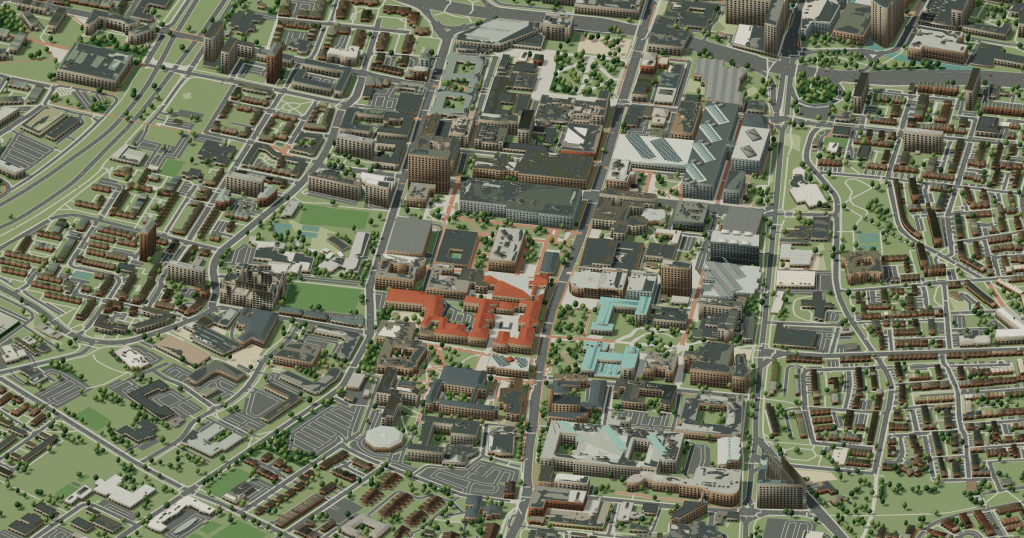
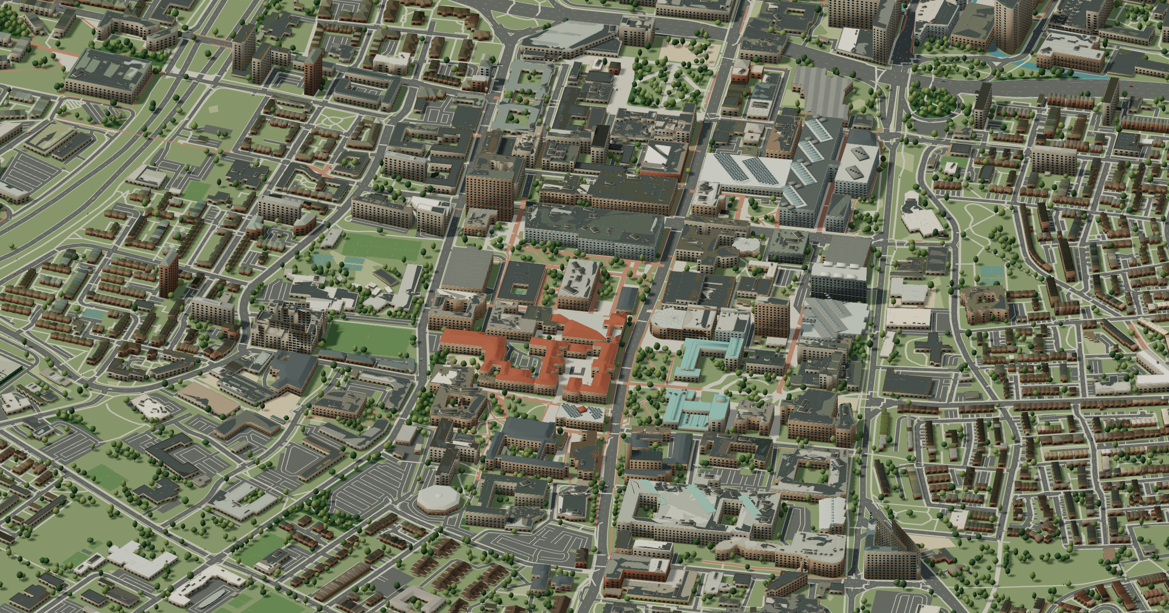
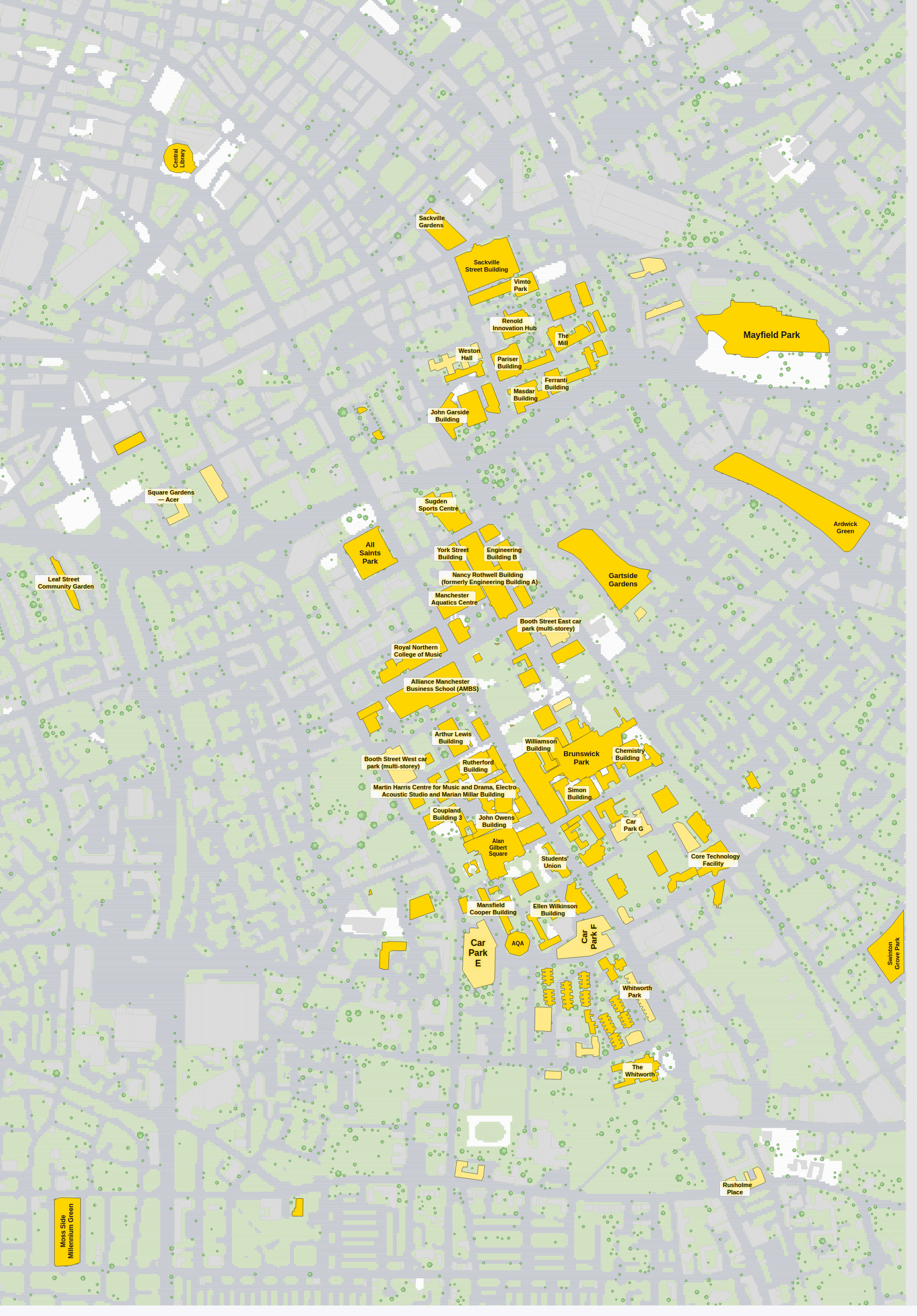
The University of Manchester stretches along Oxford Road south of the city centre, one of the busiest student corridors in Europe. Its oldest corner is the Gothic Old Quadrangle by Alfred Waterhouse, where Whitworth Hall, the John Owens Building and the Beyer Building face each other, and it was here that Ernest Rutherford’s team split the atom. Further along come the Main Library, the Students’ Union and modern science and engineering buildings, ending at the Whitworth gallery and its park. The 3D view shows how the campus threads between city streets; the 2D one pins each faculty to its block.
University of Manchester in 3D
University of Manchester 2D plan
More campus maps
- Aston UniversityBirmingham, England
- University of NottinghamNottingham, England
- University of the West of EnglandBristol, England
- University of WarwickCoventry, England
- Brunel University LondonUxbridge, London
- Heriot-Watt UniversityEdinburgh, Scotland
- Lancaster UniversityBailrigg, Lancaster
- Loughborough UniversityLoughborough, Leicestershire
- Queen Mary University of LondonMile End, London
- Royal Holloway, University of LondonEgham, Surrey
- University College LondonBloomsbury, London
- University of BathClaverton Down, Bath