

3D and 2D campus map · Heslington, York
University of York Campus Map
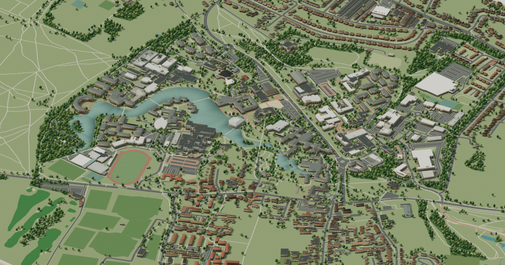
Rotate the campus, zoom in on any building and click it to see what is inside.
- Drag to orbit
- Scroll or pinch to zoom
- Click a building for details
- Right-drag to pan

Jump to a building
Pick a building to fly the map to it and open its departments and services. Every place at University of York is also searchable from the map itself.
University of York
Campus directory
Faculties, departments, libraries and services across the campus. Pick one and the map takes you there, in 3D or 2D.
No matching places. Try another name.
About this map
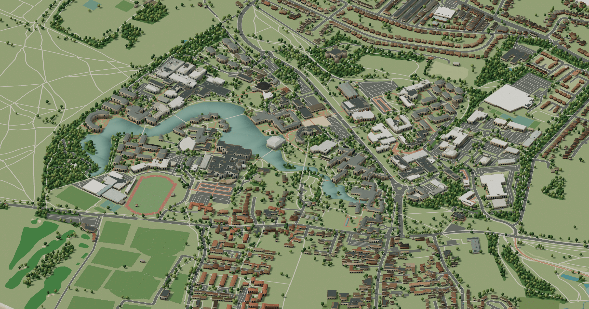
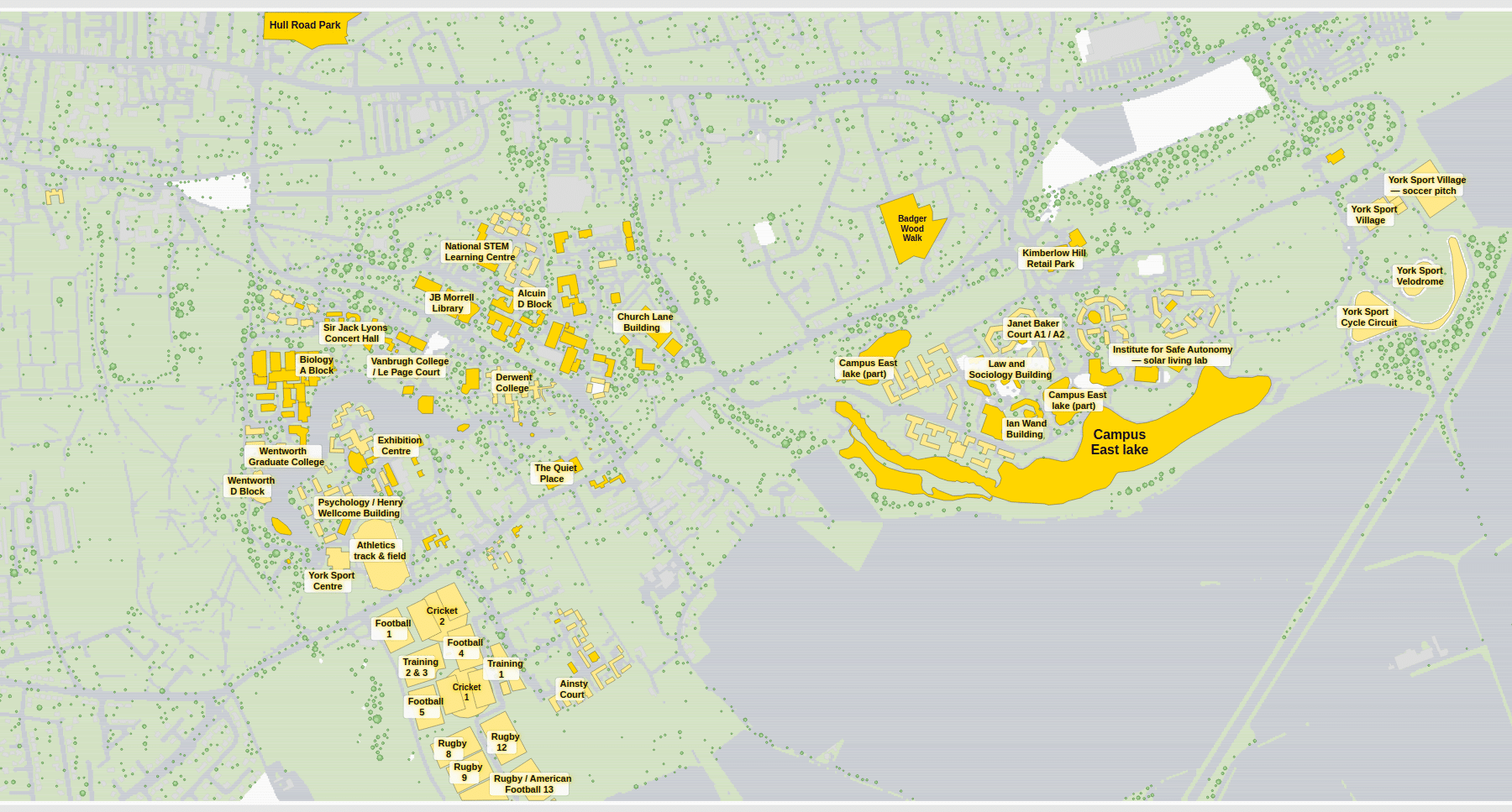
The University of York opened in 1963 on the edge of the village of Heslington, a mile or so south-east of the city walls. Its Heslington West campus was laid out around a large artificial lake, home to resident ducks and geese, with Central Hall perched on the shore and covered walkways linking the colleges. Heslington Hall, an Elizabethan manor house, holds the administration, and the JB Morrell Library stands nearby. Newer colleges and departments occupy Campus East across the fields. The 3D model shows how the water ties the campus together, and the 2D plan names each college and court.
University of York in 3D
University of York 2D plan
More campus maps
- Aston UniversityBirmingham, England
- Brunel University LondonUxbridge, London
- Heriot-Watt UniversityEdinburgh, Scotland
- Lancaster UniversityBailrigg, Lancaster
- Loughborough UniversityLoughborough, Leicestershire
- Queen Mary University of LondonMile End, London
- Royal Holloway, University of LondonEgham, Surrey
- University College LondonBloomsbury, London
- University of BathClaverton Down, Bath
- University of ManchesterManchester, England
- University of NottinghamNottingham, England
- University of the West of EnglandBristol, England